Unlocking the Potential of Remotely Piloted Aircraft Systems (RPAS) for Aerial Mapping
Aerial drone mapping stands as a remarkably cost-effective solution for swiftly surveying large areas compared to conventional methods. Surveys can be processed to produce precisely geo-referenced high-resolution imagery as well as detailed ground surface models.
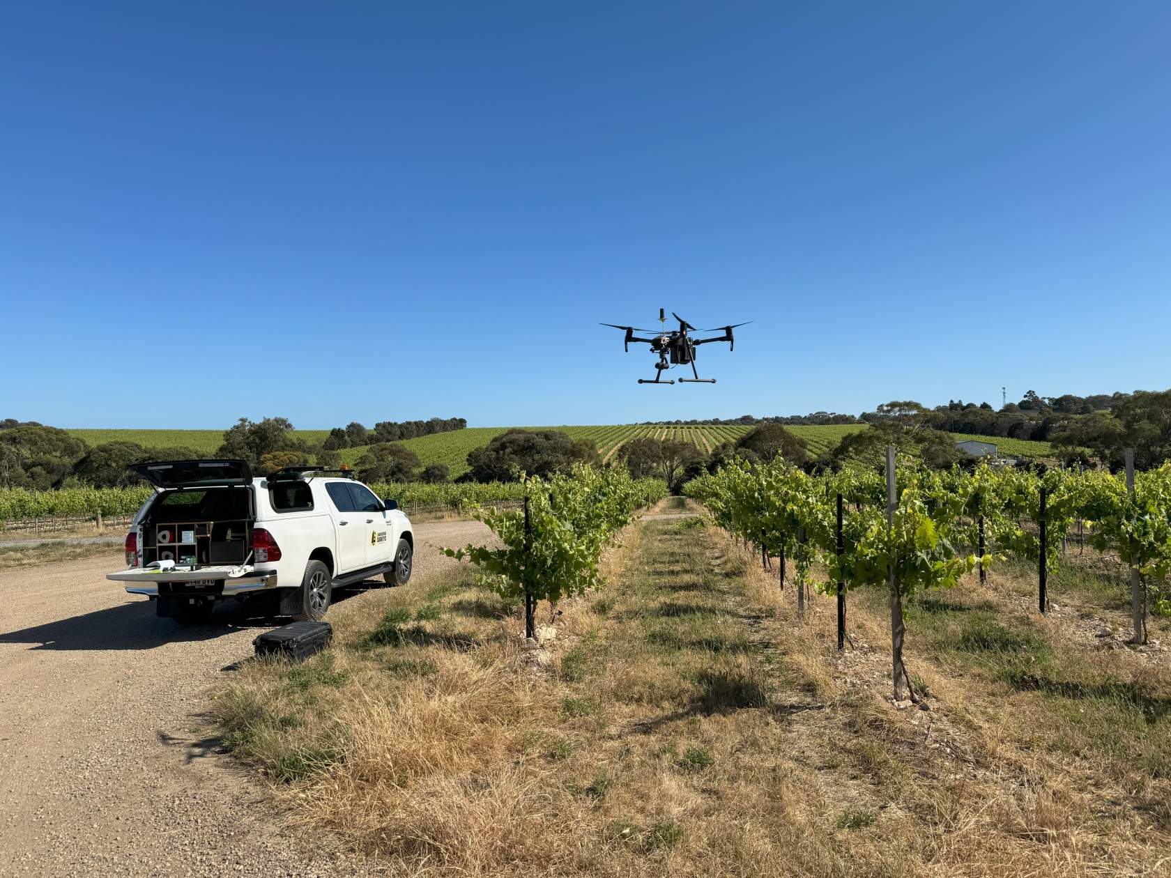
Our accredited drone pilots are experts in their field, and can advise you on the suitability of a drone survey as opposed to traditional survey methods.
The flights
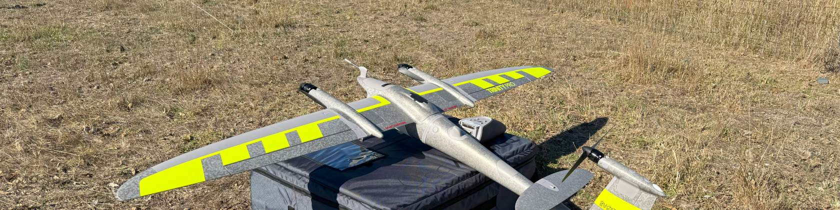
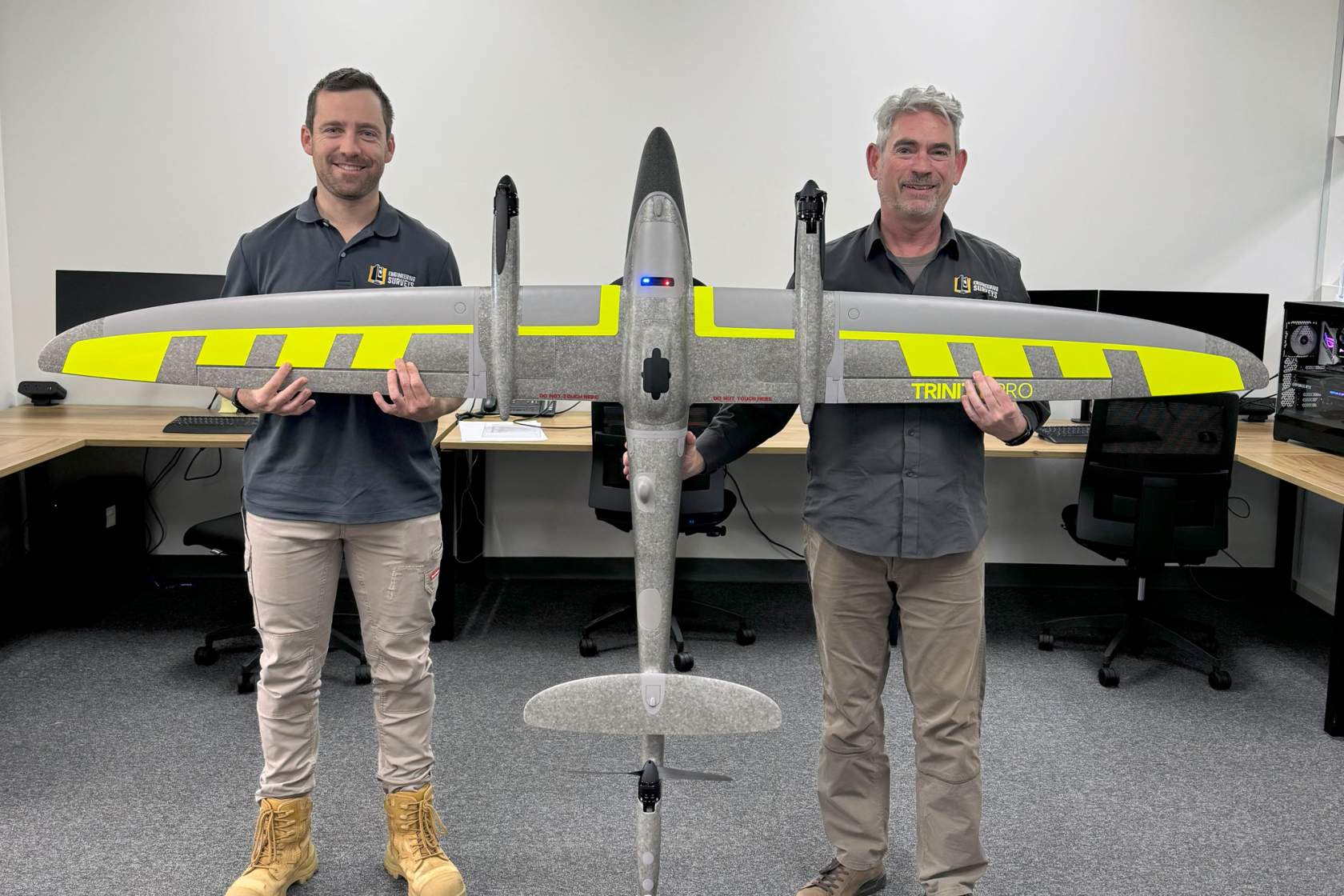
Our drones are seriously fast. We can capture large areas quickly and our VTOL fixed wing Trinity Pro is capable of covering a 2800ha area in a single day. In most cases drone flights won’t require the approval of CASA. Our accredited remote pilots will ensure safety with a CASA approved format job safety analysis, and will investigate any potential project risks and if required take steps to mitigate them.
The capture
LiDAR, imagery or both the choice is yours. Our drones can capture geo-referenced imagery which can be used to create detailed orthophoto mosaics, and through photogrammetric processing we can extract ground surface models for contouring. LiDAR is essentially a point cloud captured from the air. LiDAR has a distinct advantage over densely forested areas where the laser can penetrate through the tree canopy.
The deliverables
Deliverables produced include:
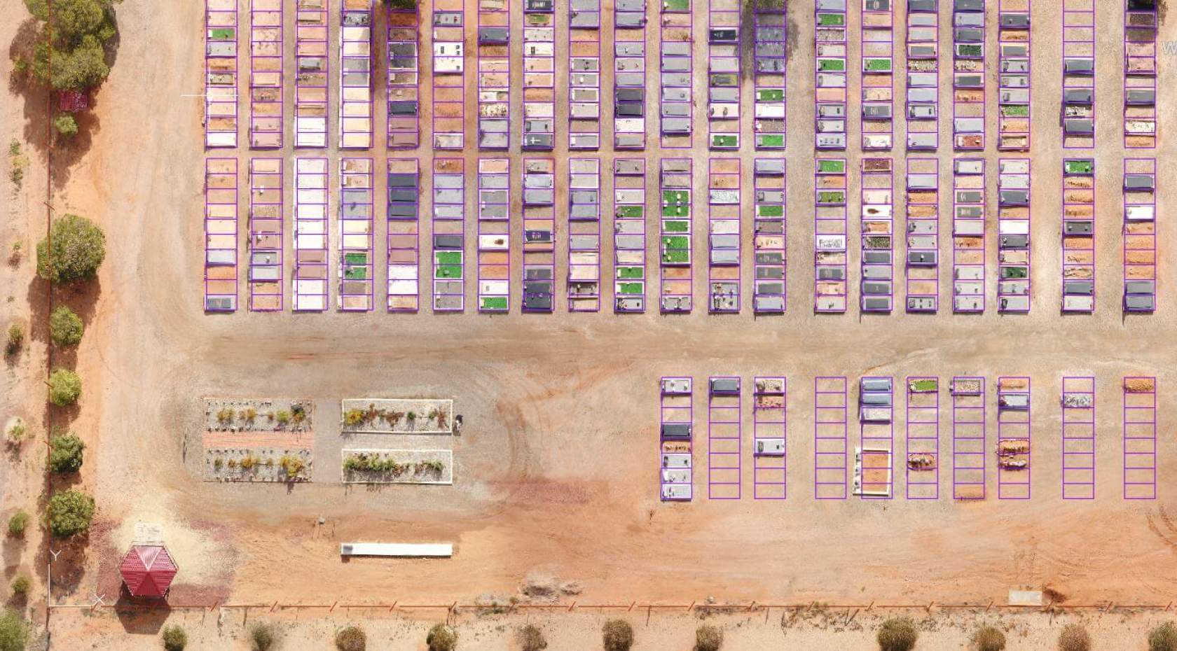
Precisely geo-referenced high-resolution orthophoto mosaics
This stunning imagery is corrected for terrain height to create a large imagery mosaic without any distortion or noticeable overlap in photography. This geo-referenced image can be displayed as an underlay in CAD or GIS software, or can be uploaded to a cloud-based workspace platform such as Propeller to assist with project planning and tracking.
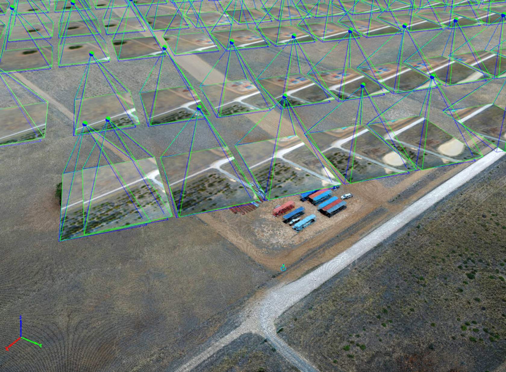
3D point clouds
These large coloured point datasets can be captured directly by LiDAR (fantastic for penetration through forest canopy) or generated through the photogrammetric process. Point clouds can be further processed by classification (ground, buildings, vegetation separate data sets for example) and can be very detailed or sampled down to smaller data sets depending on the application.
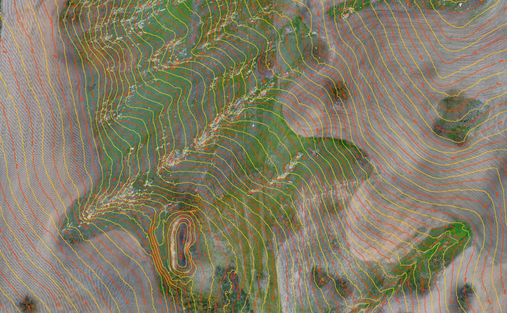
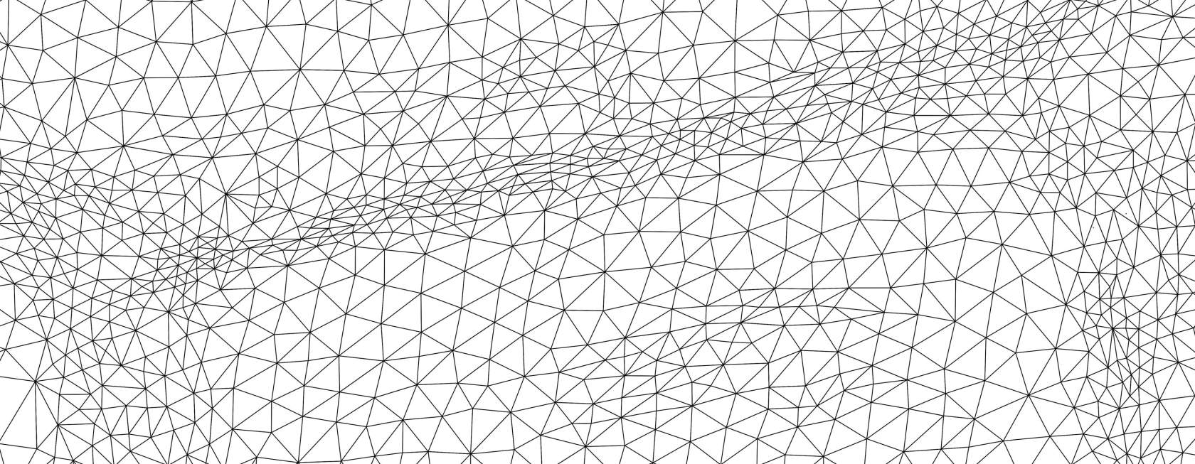
Ground surface modelling – 3D Triangulated Irregular Networks (TINs)
A very detailed 3D ground mesh is able to be produced which can be used for a range of different purposes including: topographic mapping and contours, volume calculations, hydrological analysis, slope and aspect analysis, viewshed analysis, geotechnical engineering, visualization and urban planning to name a few.
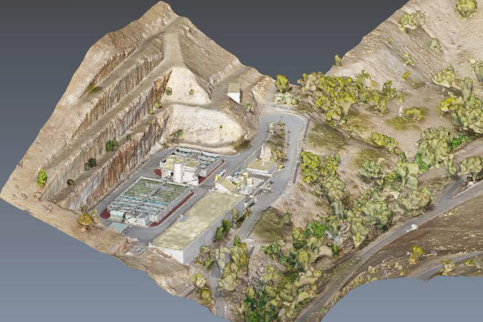
Site visualisation and fly-throughs
Besides a ground surface mesh, all other site features including buildings, trees and powerlines for example can be auto-meshed to create a great visualization tool. With this colourised mesh we can create fly-through animations which can be easily shared or used as part of a presentation.
Any of this data can be further enriched with traditional ground-sourced survey data, terrain contours, or superimposed design drawings.
Why use us?
There are a number of operators in the market offering aerial drone services - why use us? The difference is that surveying expertise can give you 100% confidence in the data collected. We use accurate ground control points (GCPs) to independently prove the data, so you can have complete confidence in the final data deliverables.
So how accurate is it? It depends partly on what accuracy you require. Flying lower can yield higher accuracy with more photos, but flying higher can cover larger areas. Typical accuracy achievable is similar to survey grade GPS or around 2cm vertically and 1.2cm horizontally.
Aerial mapping with Remotely Piloted Aircraft (RPAs) can also capture areas that are difficult, hazardous or completely inaccessible using conventional survey techniques.
Engineering Surveys Pty Ltd (ARN 1075771) is certified by the Civil Aviation Safety Authority (CASA) as a Remotely Piloted Aircraft (RPA) operator. RPA Operators Certificate (ReOC): CASA.ReOC.6662.